Map panels and location files
Download map panels and location outputs used in this SCATS + TIRTL open-data intelligence brief.
Release folder: 2026-06
Generated: 2026-06-17 18:16
| File | Description | Size | Modified |
|---|---|---|---|
| README_maps.txt | Map or location-output file. | 176 B | 2026-06-17 17:53 |
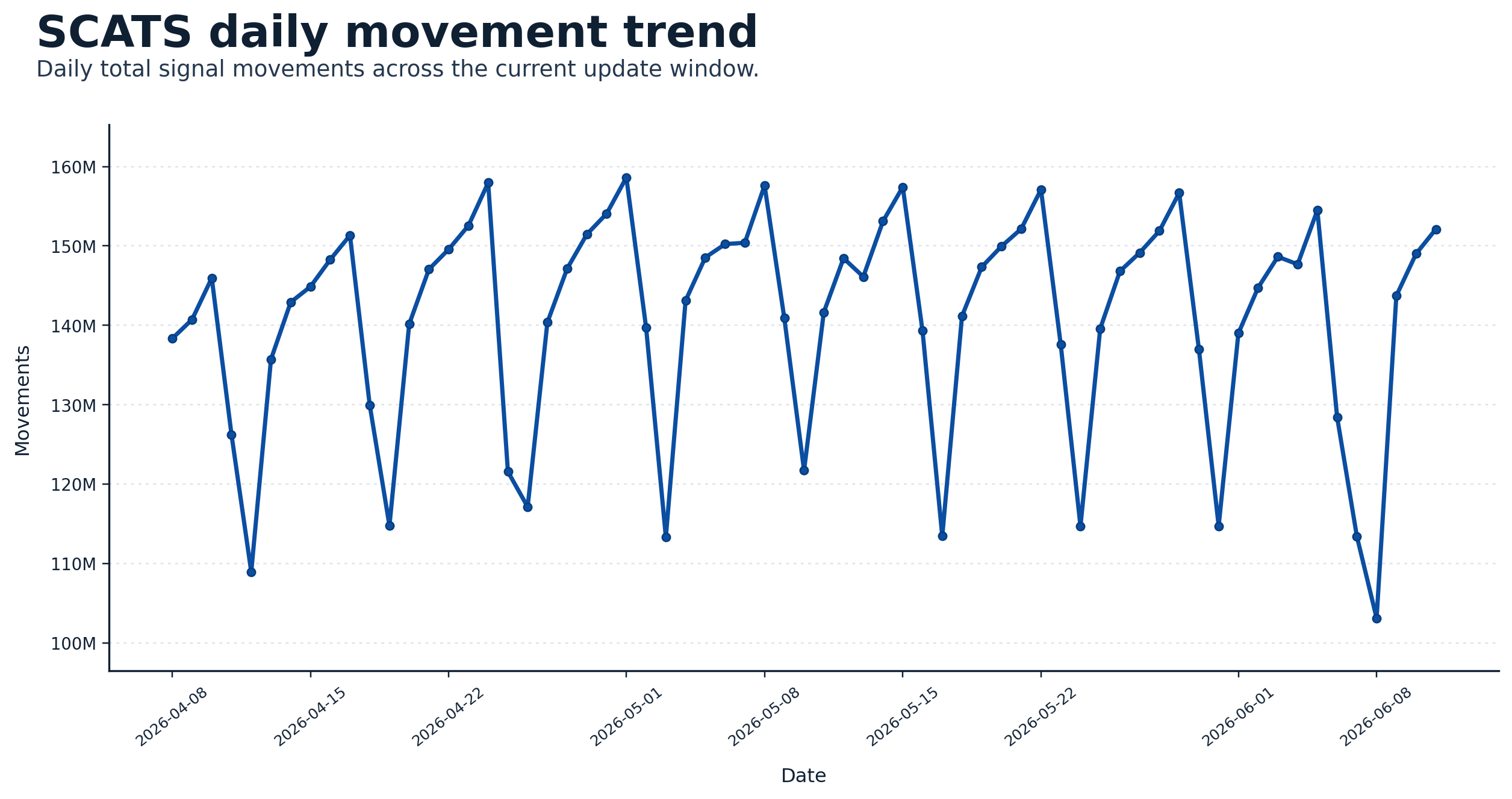
| scats_daily_movement_trend_2026-06.png | Map or image output. | 211.0 KB | 2026-06-13 17:12 |
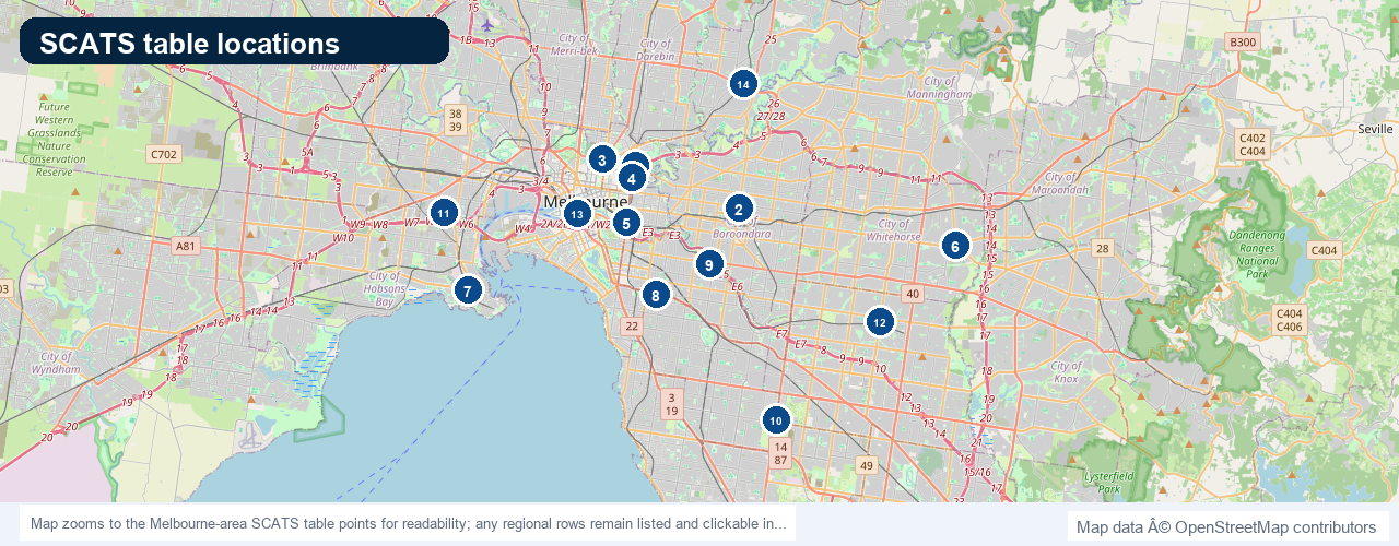
| scats_table_locations_2026-06.png | Map or image output. | 713.0 KB | 2026-06-13 14:53 |
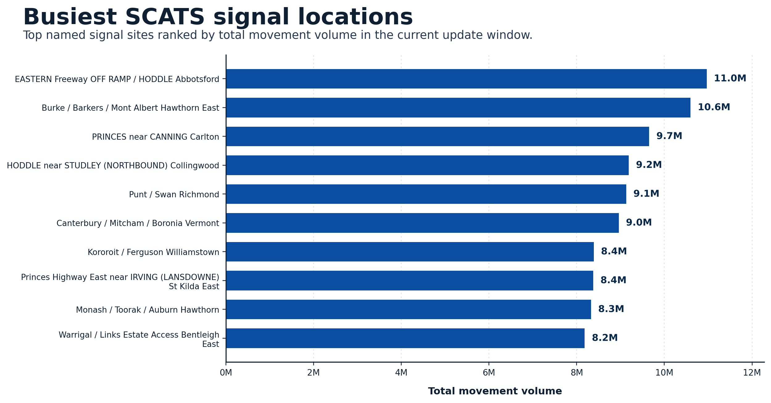
| scats_top_sites_total_volume_2026-06.png | Map or image output. | 186.6 KB | 2026-06-13 17:12 |
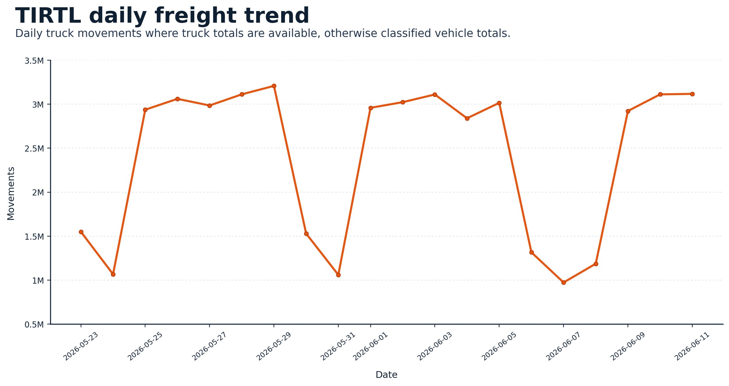
| tirtl_daily_truck_trend_2026-06.png | Map or image output. | 147.9 KB | 2026-06-13 17:12 |
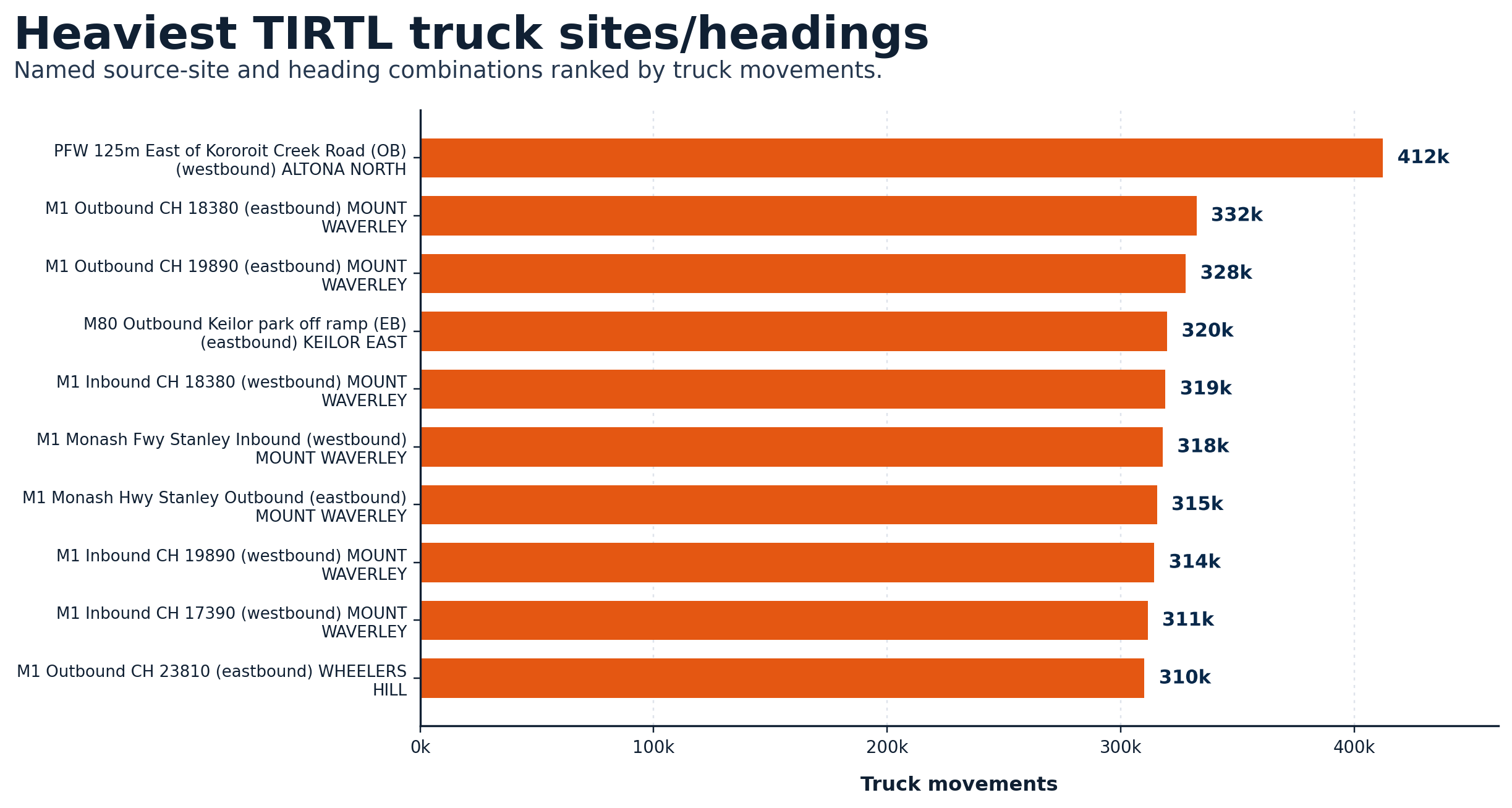
| tirtl_heaviest_truck_sites_2026-06.png | Highest-volume TIRTL truck locations. | 226.9 KB | 2026-06-13 17:12 |
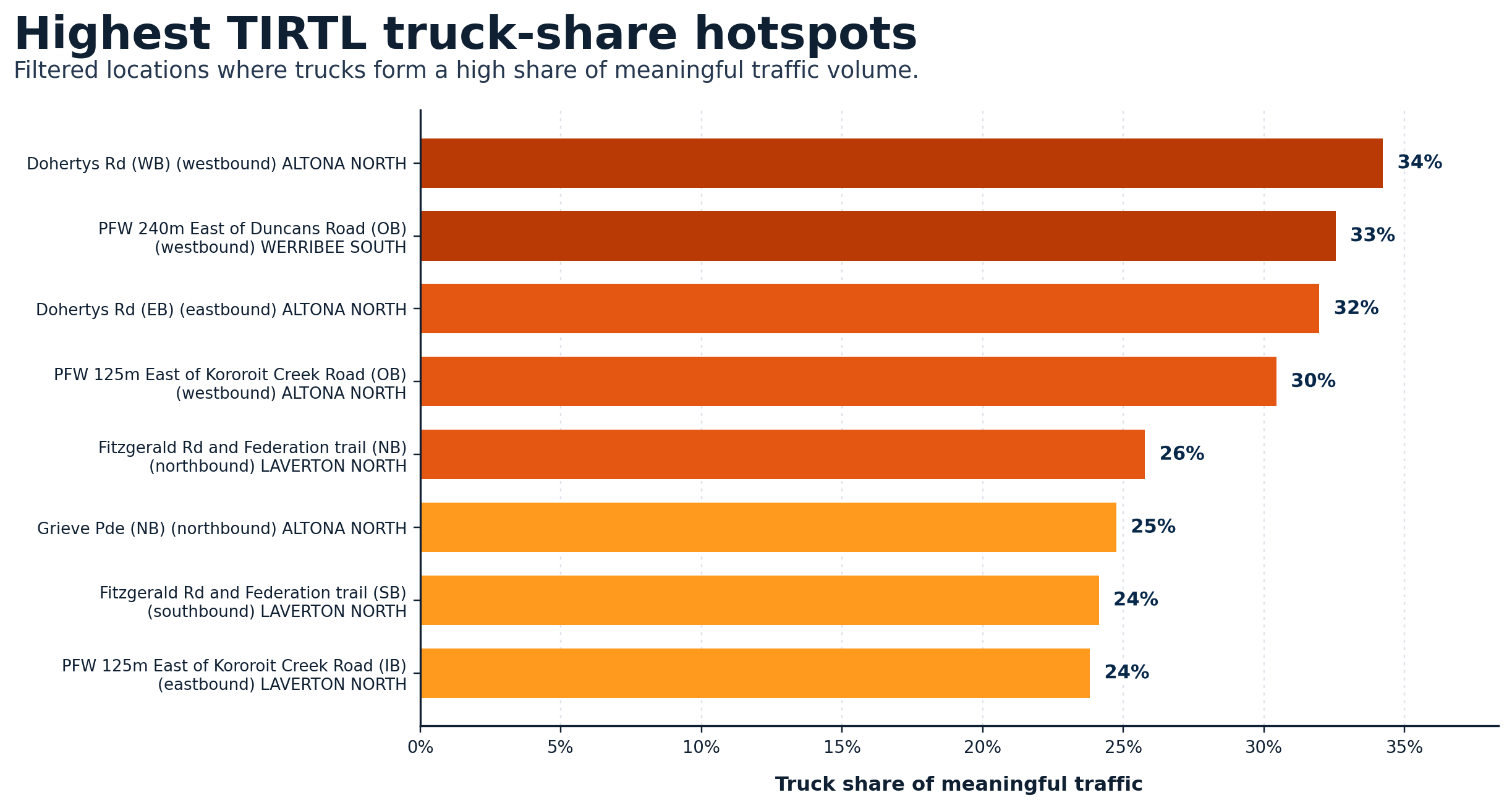
| tirtl_highest_truck_share_hotspots_2026-06.png | TIRTL locations where trucks form a high share of traffic. | 208.9 KB | 2026-06-13 17:12 |
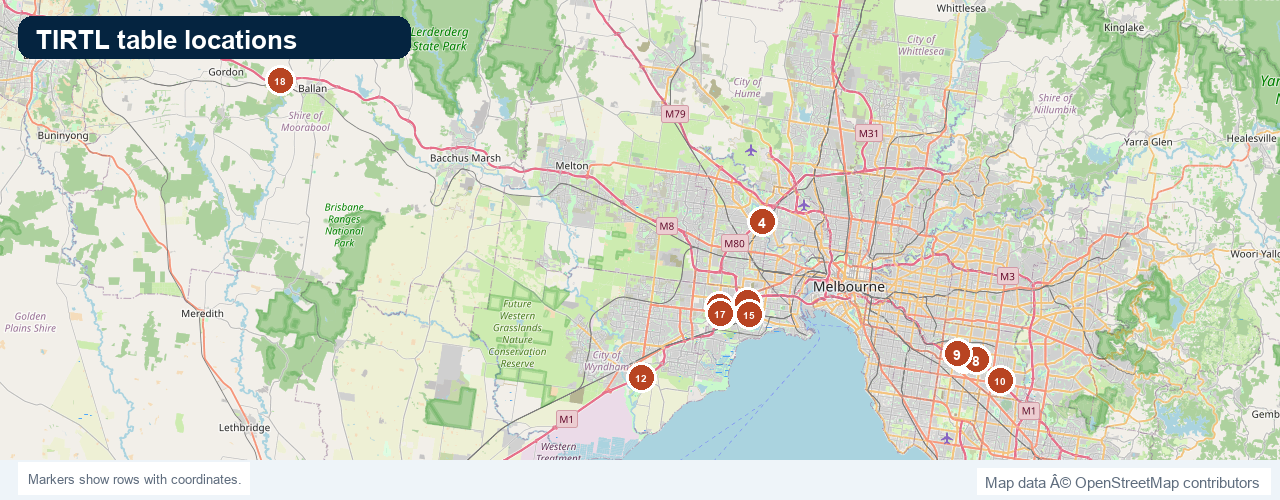
| tirtl_table_locations_2026-06.png | Map or image output. | 669.6 KB | 2026-06-13 14:53 |
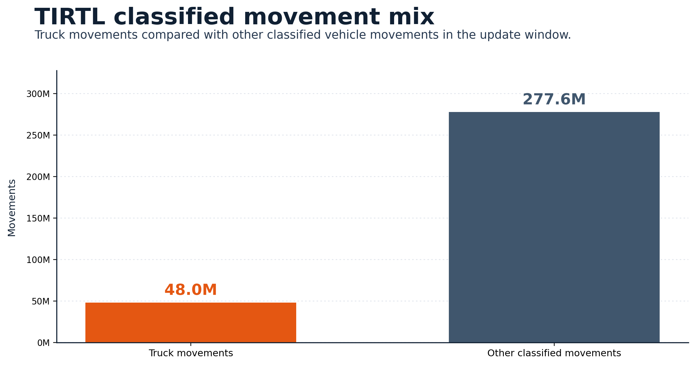
| tirtl_vehicle_truck_mix_2026-06.png | Map or image output. | 93.1 KB | 2026-06-13 17:12 |
Watchlist and anomaly files are story leads for review, not automatic proof of cause.