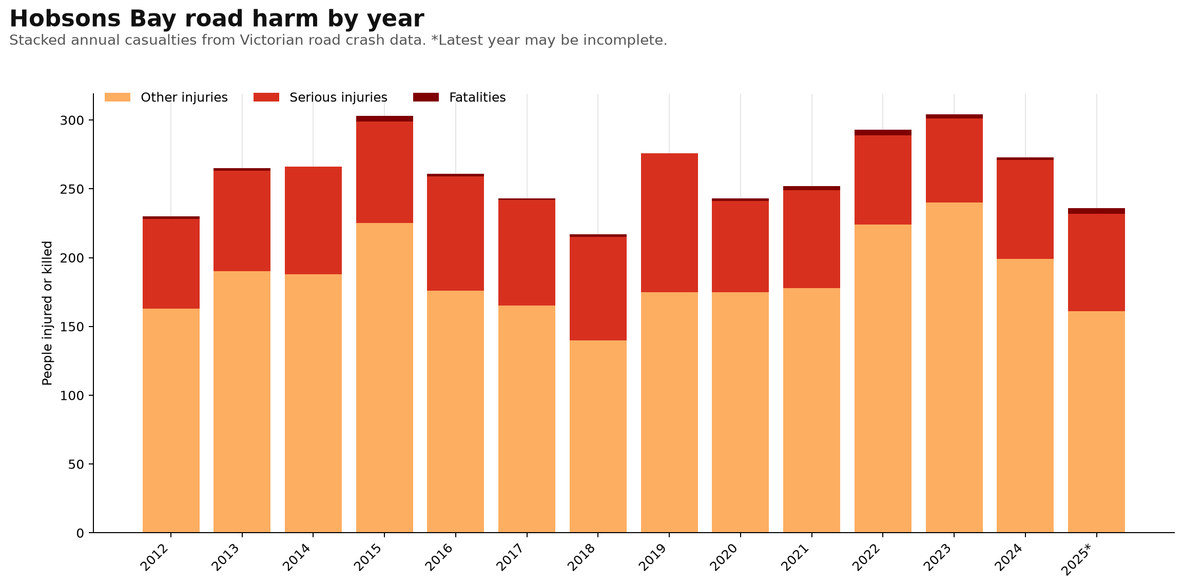
Hobsons Bay road harm by year
Stacked annual fatalities, serious injuries and other injuries.
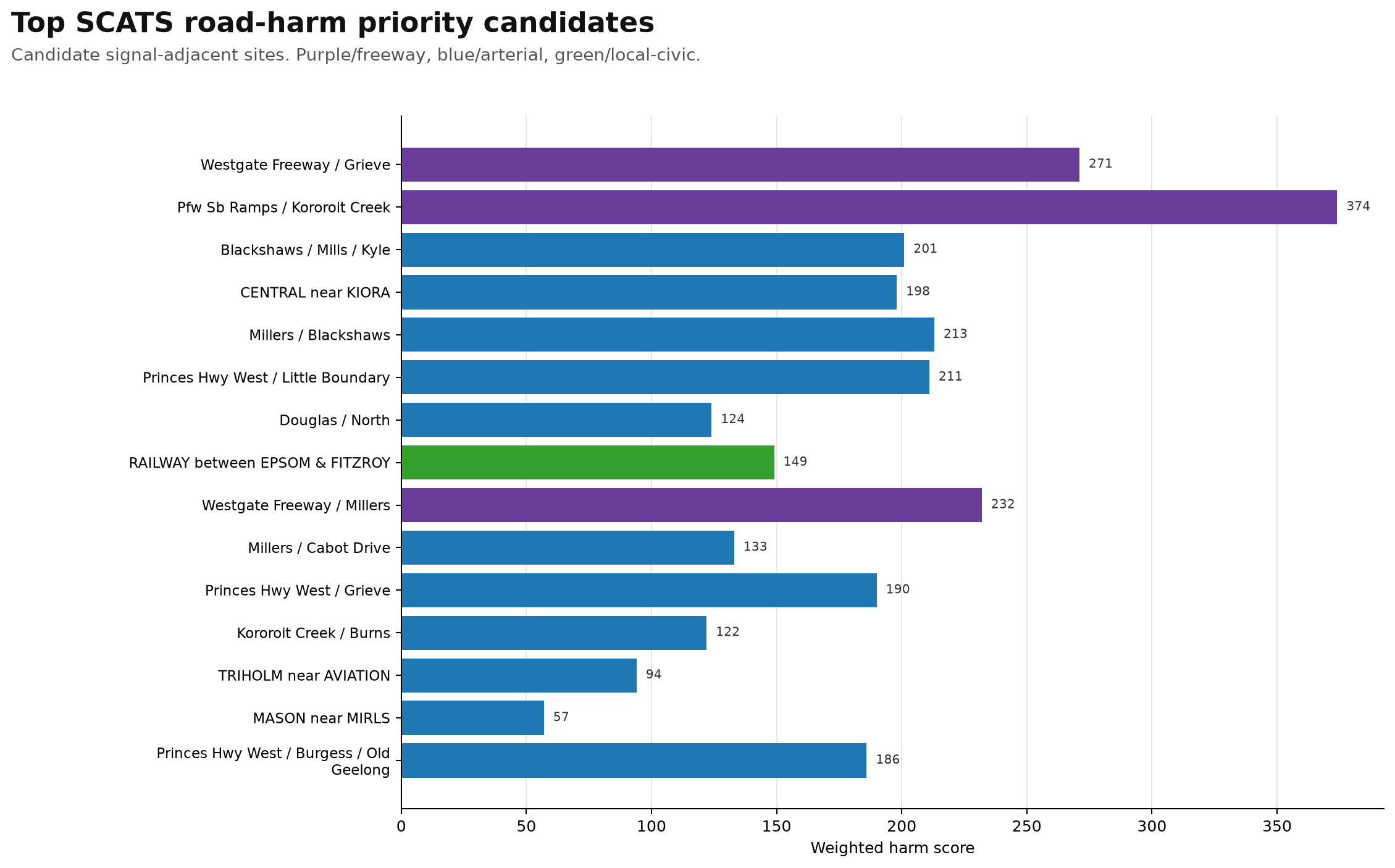
Top SCATS road-harm priority candidates
Candidate signal-adjacent sites. Purple/freeway, blue/arterial, green/local-civic.
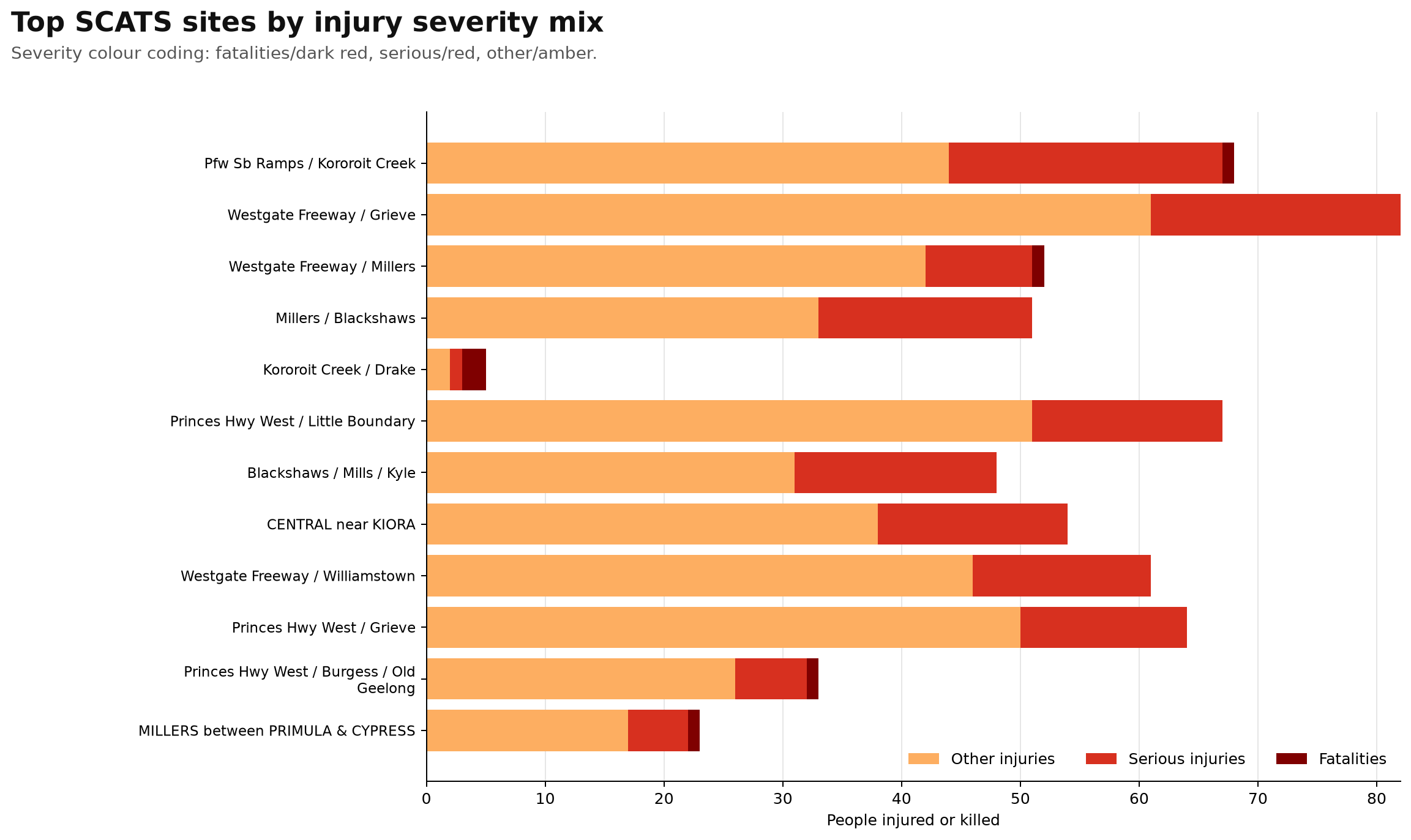
Top SCATS sites by injury severity mix
Severity colour coding: fatalities/dark red, serious/red, other/amber.
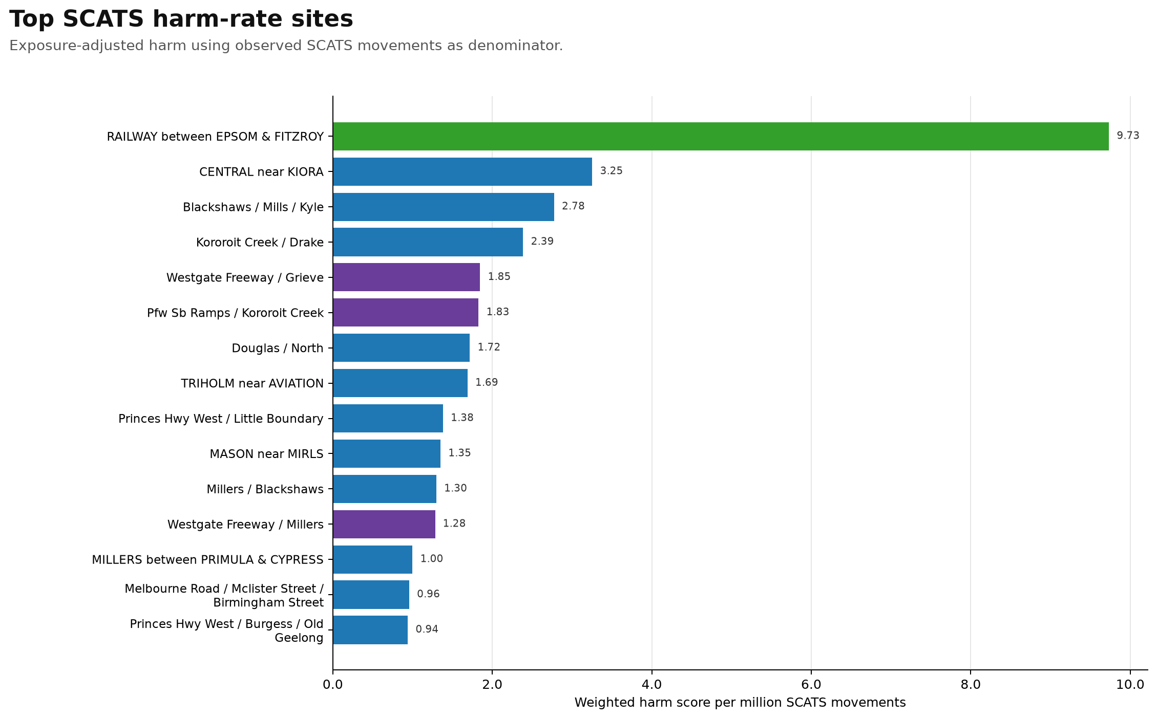
Top SCATS harm-rate sites
Exposure-adjusted harm using observed SCATS movements as denominator.
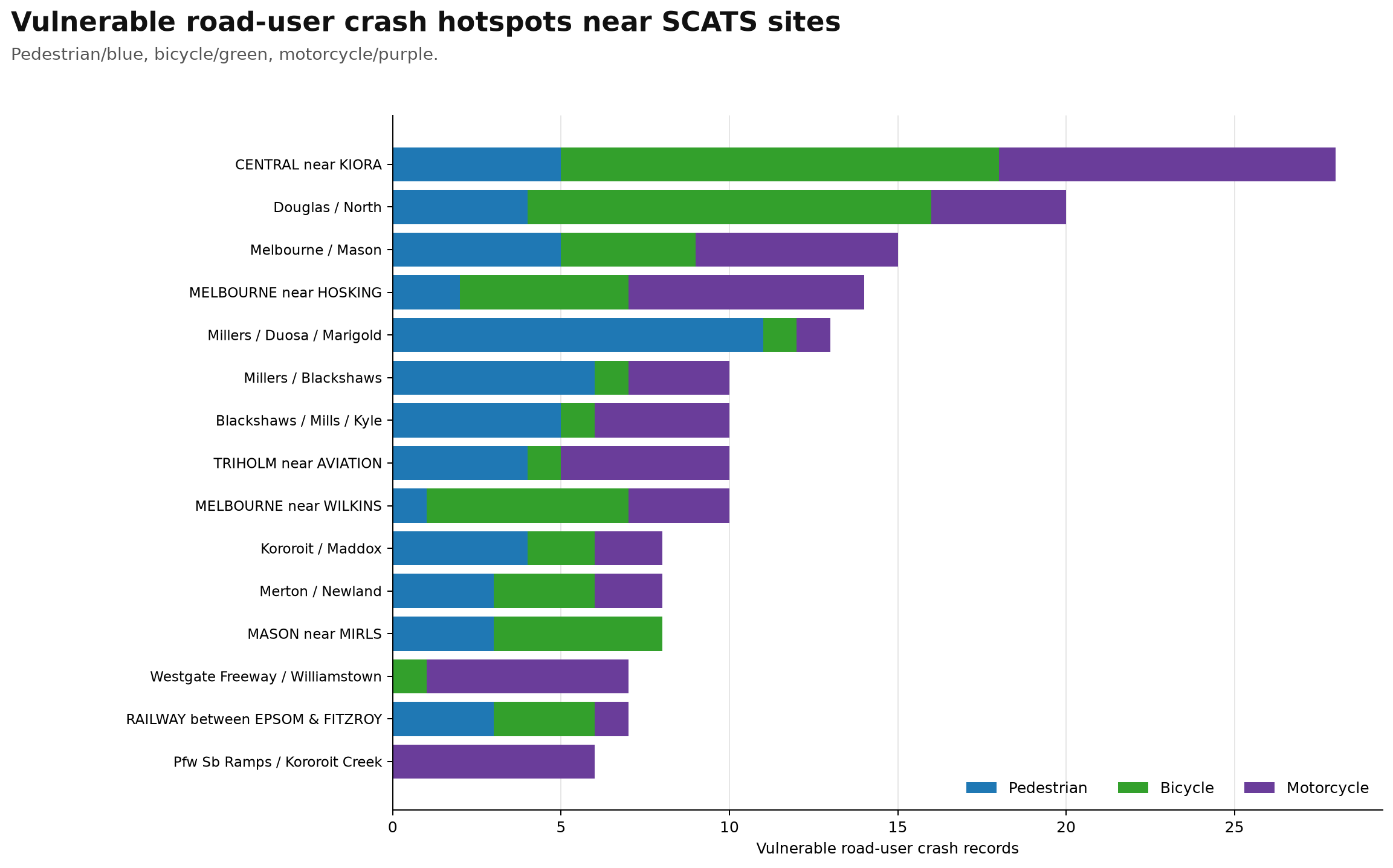
Vulnerable road-user crash hotspots near SCATS sites
Stacked pedestrian, bicycle and motorcycle crash records.
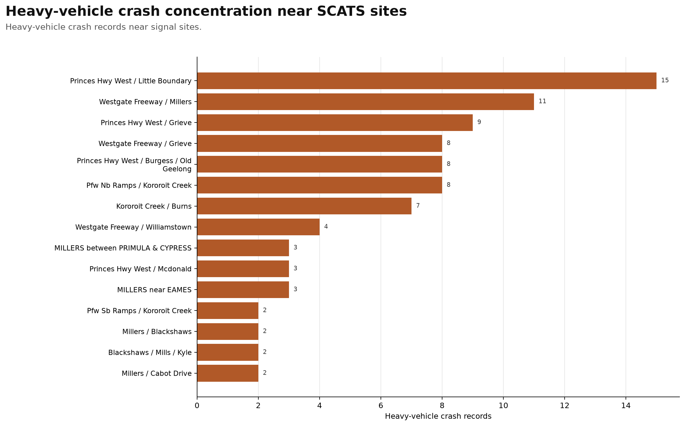
Heavy-vehicle crash concentration near SCATS sites
Heavy-vehicle crash records near signal sites.
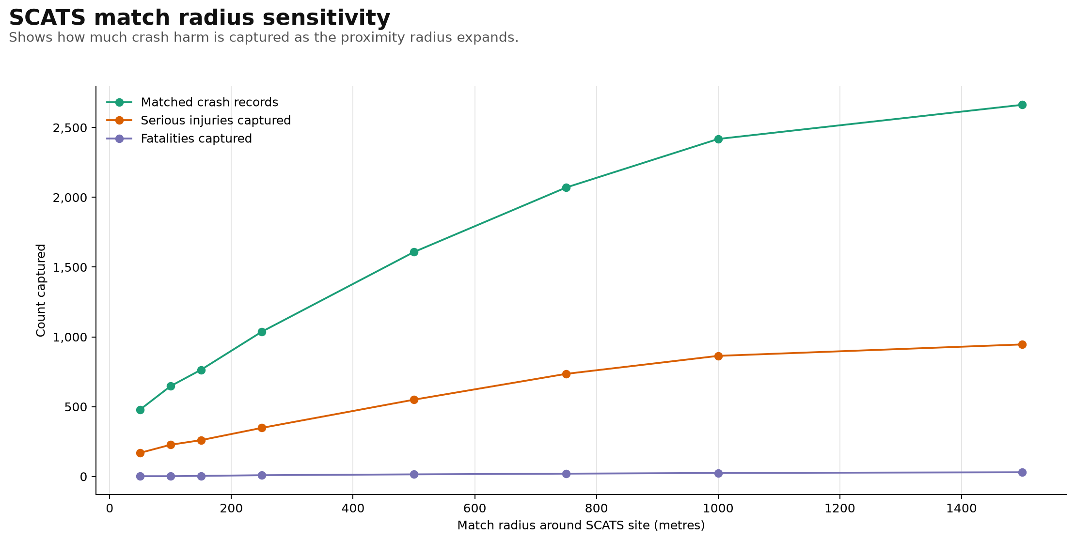
SCATS match radius sensitivity
Shows how much crash harm is captured as the proximity radius expands.
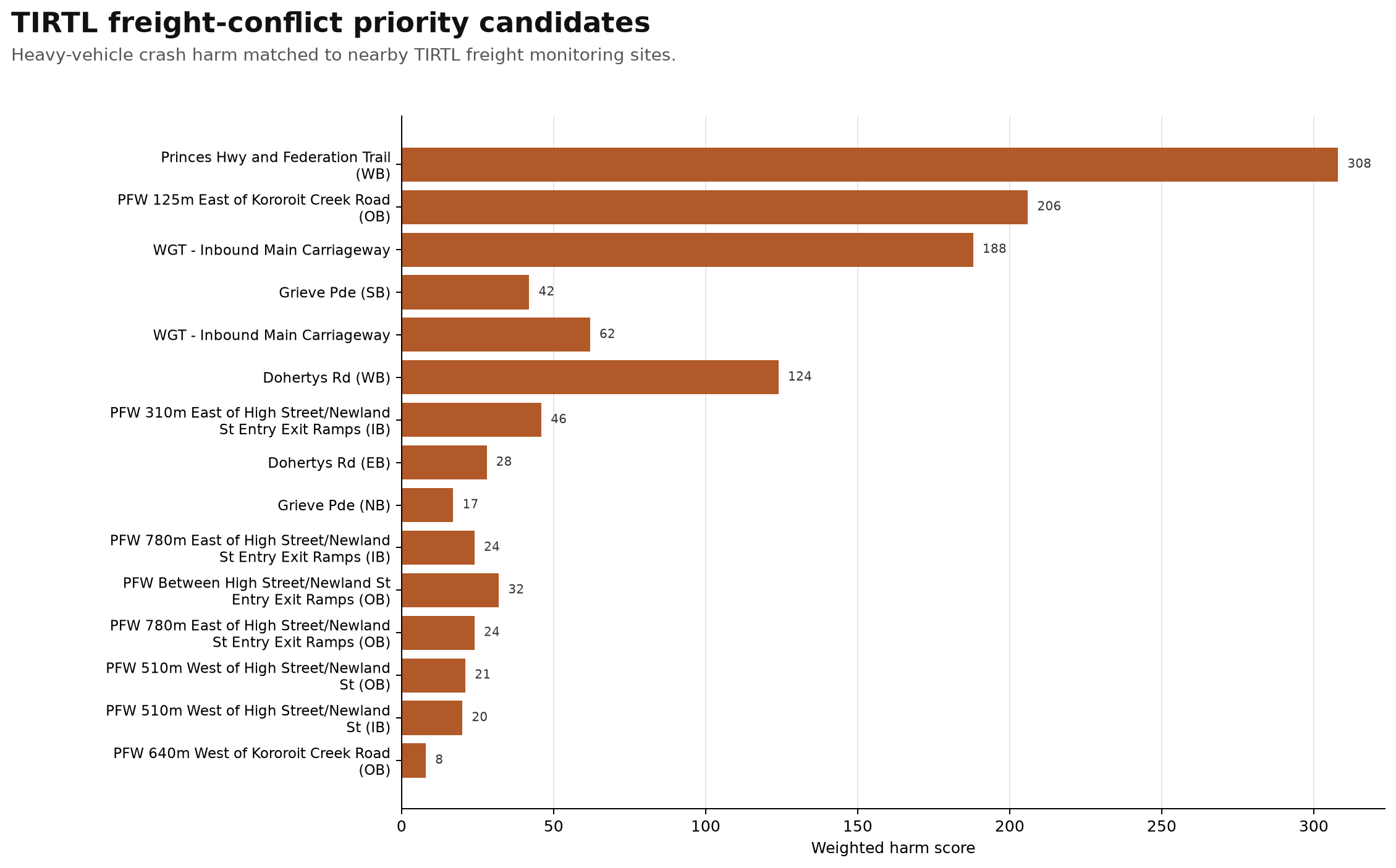
TIRTL freight-conflict priority candidates
Heavy-vehicle crash harm matched to nearby TIRTL freight monitoring sites.
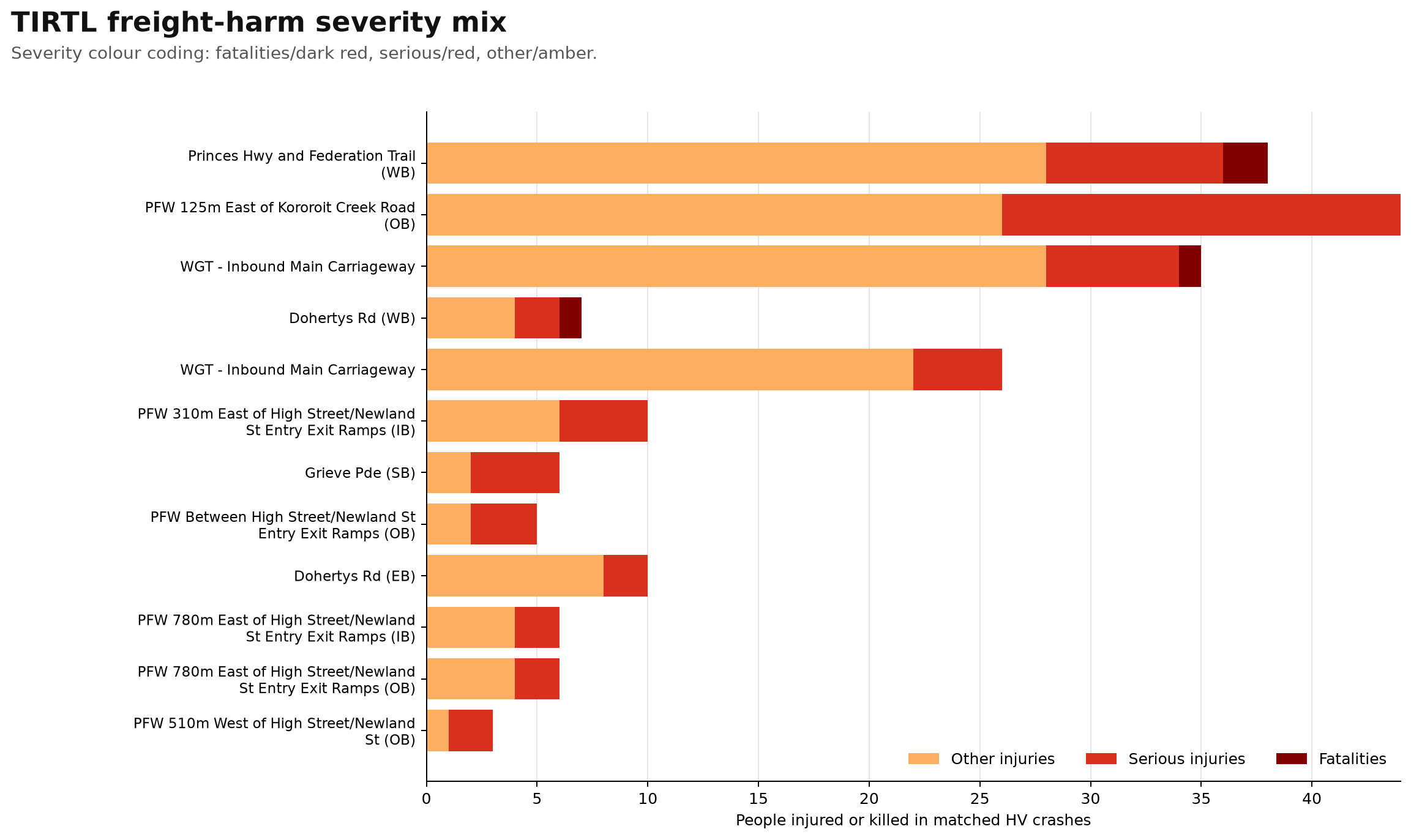
TIRTL freight-harm severity mix
Severity colour coding: fatalities/dark red, serious/red, other/amber.
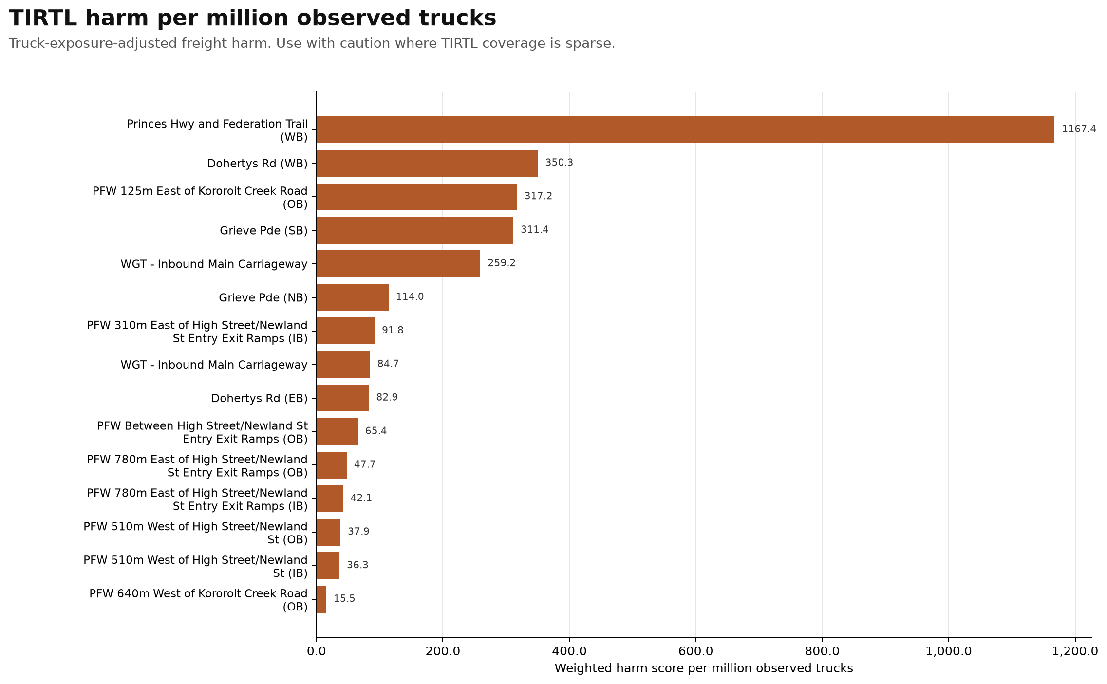
TIRTL harm per million observed trucks
Truck-exposure-adjusted freight harm. Use with caution where TIRTL coverage is sparse.
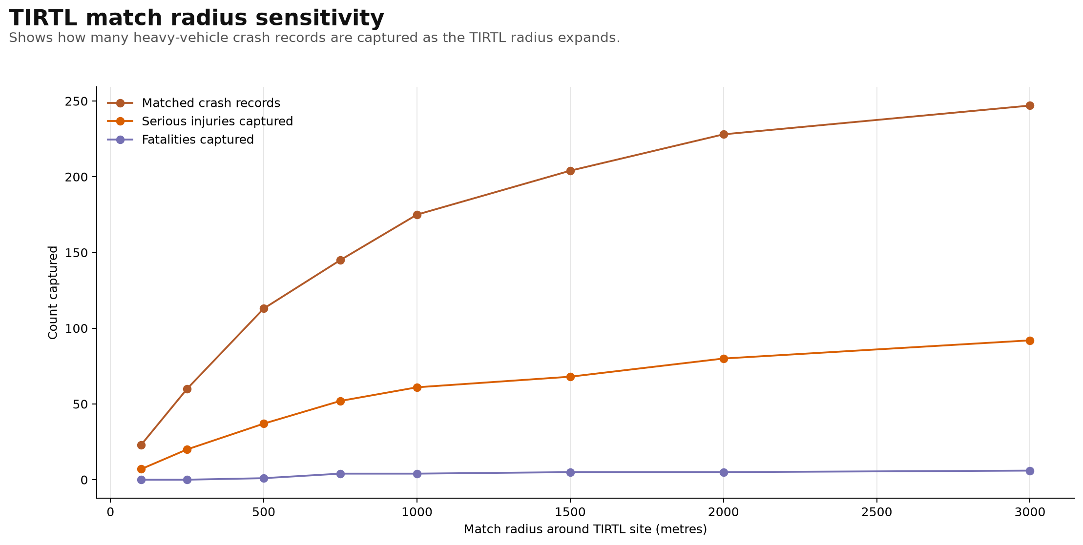
TIRTL match radius sensitivity
Shows how many heavy-vehicle crash records are captured as the TIRTL radius expands.
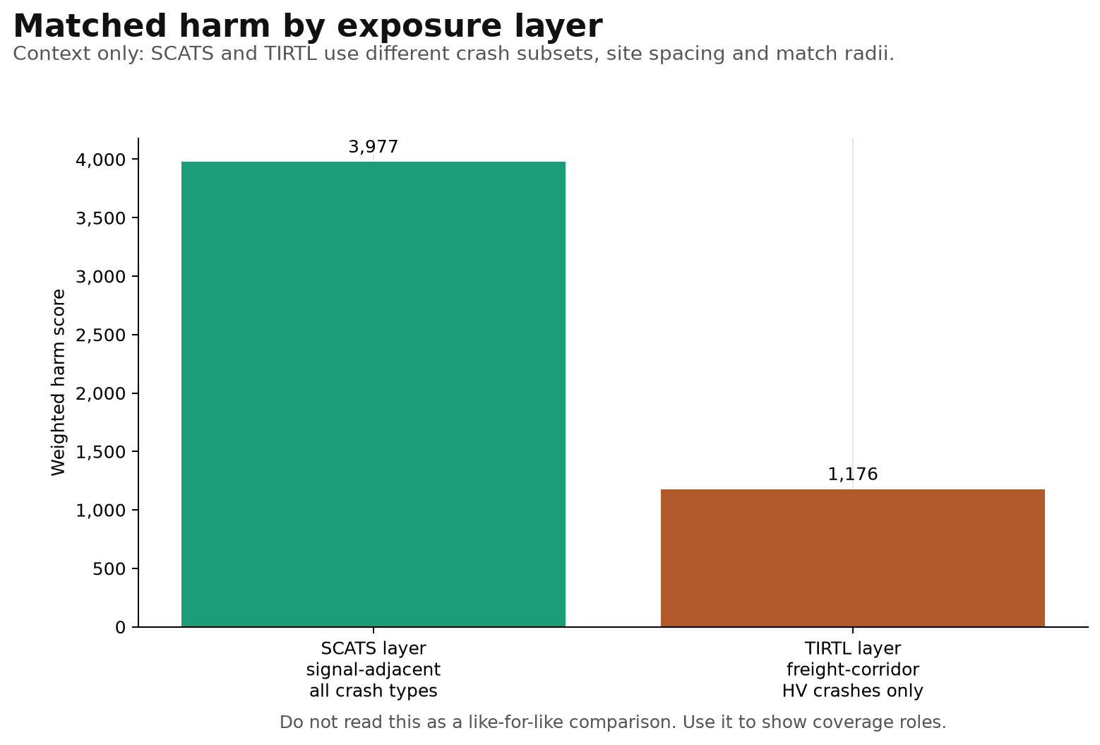
Matched harm by exposure layer
Context-only comparison of SCATS and TIRTL matched harm layers.